
Object Record
Images
Metadata
Object Name |
Map, Plat |
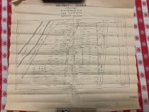
Description |
Unrecorded plat map of the Walbert Acres development in Section 35, Township 9 North, Range 2 West, on either side of the Old Pacific Highway (now Pleasant Hill Road), west of the Super Highway (Interstate 5), just north of the north line of the J. F. Stock D.L.C. Shows each tract with their acreage, and Walnut Road which crossed I-5. Plat drawn by cartographer W. T. Vitous. |
Date |
Sept. 1951 |
Dimensions |
W-17.5 L-16.125 inches |
Place of Origin |
Pleasant Hill |
Search Terms |
Pleasant Hill maps |
Catalog Number |
2024.0027.0011 |